GIS • Development • Design • Drone
Work Experience
Work
experience
Geospatial Analyst, United Nations Operational Satellite Applications Programme
(UNOSAT - UNITAR) (Geneva, Switzerland) - December 2020 - Present
Skills include:
-
Geospatial and remote sensing analysis for development projects (including ESRI ArcGIS Pro, ArcGIS Online and QGIS)
-
Map creation and templating
-
Creation of written geospatial training/ tutorial materials
-
Working on data presentation and mapping within the United Nations system
Consultant, United Nations Economic and Social Commission for Asia and the Pacific (ESCAP) (Bangkok, Thailand) - May 2018 - May 2019, July 2020 - Nov 2020
Skills include:
-
Project consulting, reporting and documenting
-
Working within the United Nations system (including UN writing style, diplomacy)
-
Engaging with colleagues, member States and experts from around Asia-Pacific region
-
Contributing technical geospatial knowledge on implementing action plans and reports
-
Working closely with the Sustainable Development Goals (SDGs) and other UN standards
I was part of the core drafting team for the publication, 'Geospatial Practices for Sustainable Development in Asia and the Pacific 2020", where I contributed technical knowledge and advice, along with media assistance and organisation of the publication launch. All links relating to this can be found below:
-
Geospatial Practices for Sustainable Development in Asia and the Pacific 2020
-
Summary Document - Geospatial Practices for Sustainable Development in Asia and the Pacific 2020
Additional Documents/ projects worked on:
-
Asia-Pacific Plan of Action for Space Applications for Sustainable Development
-
Infographic representation of the Plan of Action (developed by me)
-
Technical paper (prepared by me): Good practices and emerging trends on geospatial technology and information applications for the Sustainable Development Goals in Asia and the Pacific
-
Technical paper (contributed to): Geospatial tools to support the implementation of the Sustainable Development Goals in Asia and the Pacific: the drought riskscape and the Regional Drought Mechanism
Research Associate, August 2017 - May 2018 | Intern, March 2017 - August 2017
Geoinformatics Center - Asian Institute of Technology (PathumThani, Thailand)
Skills include:
-
Responding to real-world situations using geospatial services for projects and tasks
-
Creating and developing complex ArcGIS online mapping content solutions
-
Managing ArcGIS Server and creating data-bases
-
Running and hosting training courses (ArcGIS online and drone/ UAV)
-
GIS and Remote Sensing analysis (particularly in the field of disaster management)
-
Design for brochures, flyers, newsletters and business cards.
-
Video editing
Projects worked on:
-
Drone 3D modelling using Bentley Systems
-
ArcGIS online story maps (More can be found under portfolio).
Other involvements
Events involved in/ attended:
-
NIES Conference, KL Malaysia (23 - 24 Jan 2018): 3rd International Forum On Sustainable Future in Asia- 3rd NIES International Forum
-
Speaker at the Girls in ICT day hosted by the Ministry of Digital Economy and Society Thailand the ITU, in partnership with UNESCO, FAO and CISCO - titles "Agritech Using ICTs" (27 April 2018).
-
74th Session of the Economic and Social Commission for Asia and the Pacific
-
75th Session of the Economic and Social Commission for Asia and the Pacific
Workshops and Conferences:
-
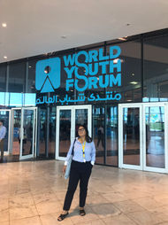
Fully funded conference attendee at the World Youth Forum - Sharm El Shiek, Egypt (1 - 9 November 2018)
-
Attended the UNITAR/ UNOSAT training on Operational Application of Geospatial Information Technology for the UN in Asia and the Pacific - Bangkok, Thailand (7 - 10 May 2019).
-
Drone imagery and work featured at the Fraser Coast Drone and Innovation Showcase - Maryborough, Australia (19 June 2019).
-
Scholarship recipient at the World of Drone Congress - Brisbane, Australia (26 - 27 September 2019).
-
Speaker at GeoRabble, Melbourne 2019


